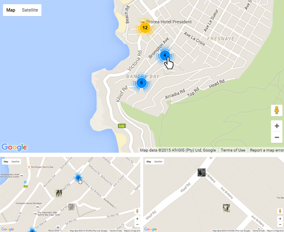
Location Based Browsing
This functionanlity provided a locatipn based browsing map iterface placing items from the archive on a map in the location they were captured. Due to the incomplete information within the archive users are able to place items on the map. Map based browsing provides a high level analysis of archive items and their relationships. Able to make conclusions about specific locations based on the information provided.
Figure 1: Screenshot
Reuirements
Create a browse interface for location-based browsing where items in the archive are visually placed on the map in the location they were taken. Each item is associated with a point. Create a second browse interface for collection based browsing, where a specific region or area, e.g. a house, represents a collection or album by providing a clickable outline of the region.
Figure 2: Use Case Narative for Location Based Browsing

Design and Implementation
Figure 3: Sequence Diagram for Maps
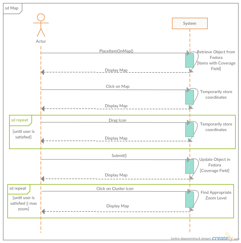
This functionality was created using the Google Maps API, used to create interactive maps interfaces as well as using external JavaSCript libraries like MarkerClusterer.js
Evaluation and Results
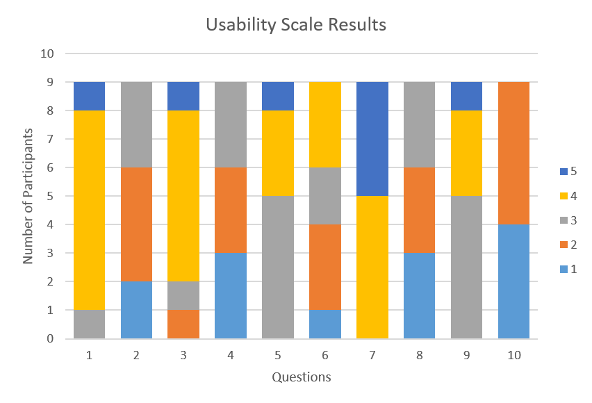
Evaluation of the system was done using Usability Tests, User Acceptance Testing and Expert Evalaution. The results are as follows:
Figure 3: User Acceptance Test results

Figure 3: Usabitiy Survey Results