Project Breakdown
Different sections of the project.
-
Data Collection
Topology Discovery
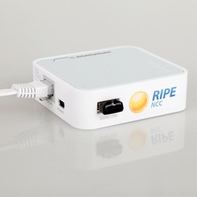
Using the RIPE Atlas platform, Traceroute measurements were conducted with three protocols (ICMP, UDP, TCP) from 12 probes to 50 destination IP addresses. After this analysis was done to identify overlapping paths to reduce packets sent and increase efficiency.
-
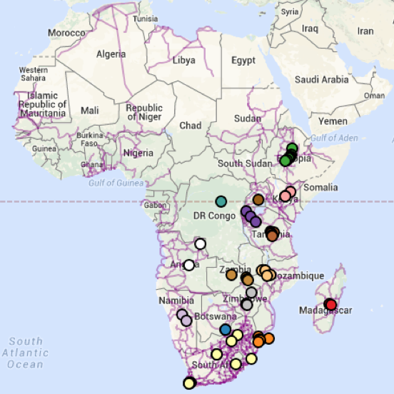
Geospatial Visualisation
Visualising Traceroute Data
Using Traceroute data collected from the Ripe Atlas platform, a geospatial visualisation was created visualising the network topology of institutions and NRENs in Southern and Eastern Africa. The effectiveness and accuracy communicating the network topology and routes of potential traffic traversal was then assessed.
-
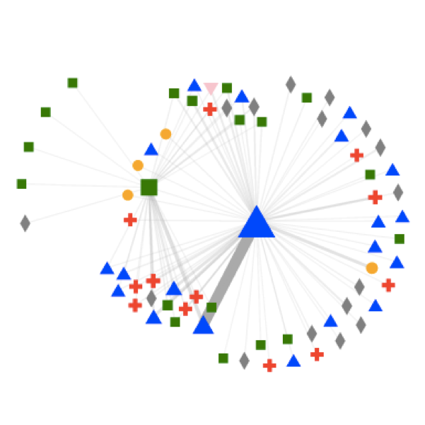
Non-Geospatial Visualisation
Visualing NetFlow Data
An interactive visualization dashboard was designed using NetFlow data collected at an African NREN. The visualisation helps African NRENs identify the biggest communication partners that transfer traffic through their network and the characteristics of that traffic.
-
UCT
CS
2015